How we researched - Method description
ABSTRACT
Snow and ice in high mountain areas play an important role in alpine livelihoods and the
surrounding regions.
Changes in the mountain cryosphere can indicate changes in the atmosphere and hence are
important for climate research. To record such changes, it is necessary to implement
monitoring networks. Remote sensing brings enormous potential for monitoring the mountain
cryosphere and even small-scale changes can be detected with high temporal resolution.
The mountain cryosphere - including glaciers, snow, and permafrost - has significant
importance to mountain areas and surrounding regions. About ten percent of the world
population lives in high mountain areas within a distance less than 100 km from glaciers or
permafrost in mountain regions (Hock et al., 2019). Hence, it is important to consistently
gain more knowledge about the mountain cryosphere through remote sensing and monitoring.
Water and energy supply, tourism, the risk of natural hazards, the mountain ecosystems, and
other impacts on social-ecological systems highly depend on glaciers and snow cover (Vaughan
et al. 2013).
Observing snow cover is important for a better process understanding in the cryosphere. The
relation between snow and mass budgets of glaciers, as well as fluctuations caused by
climate change, are a key subject of hydrological and glaciological research.
Overall, remote sensing of high alpine environments brings effort in the exploration of
inaccessible areas in the mountains. Different methods enable the coverage of large hard
accessible areas and bring monitoring possibilities with a high temporal resolution
(Helfricht et al. 2015).
STUDYAREA
The study area is situated in the upper Rofental which is part of the Ötztal.
Hintereisferner (HEF) is a typical valley glacier located on the northern side of the Austrian
alps main ridge and part of the Ötztaler Ache river catchment. HEF is the main source of the
Rofenache which is the headstream of the Ötztaler Ache (Gattermayer 2013: 110). The Ötztaler
Ache drains into the Inn and is important for its water supply, especially in the summer months,
when it releases water stored as snow and ice. The main glacier spreads from high elevation
accumulation areas below the summit of Weißkugel (3739 m) through the valley in the
north-eastern direction.
The glacier covers an area of 6,39 km2 at a length of 6,5 km with an elevation ranging from 3720
m a.s.l to 2505 m a.s.l. at the end of the tongue in 2018 and is one of the biggest glaciers of
Tyrol. In the hydrological year of 2017/18, the Equilibrium-line Altitude (ELA) of HEF was
identified at 3500 m a.s.l. (Kaser & Juen 2018: B1).
Today, the actual HEF area contains three different smaller glaciers that have been separated in
the last decades. The situation today is shown in Figure 3. In this case study, Hintereisferner,
Langtauferer Jochferner, and Stationsferner are treated as one glacier and named
“Hintereisferner” (HEF). In 2018, Hintereisferner had an extent of 5 km2, Stationsferner 0,25
km2 and Langtauferer Jochferner 1 km2 (Klug 2019).
The upper Ötztal including the Rofental is a so-called inner alpine dry valley. The distance to
the fringe of the alps and shadowing caused by high mountains affect the precipitation that is
low in the valley and increases with rising altitude (Kuhn et al. 1982). There are two
meteorological research stations close to HEF. Vent, a village about 8 km west of the end of the
glacier, and Hintereis Research Station, which is located on the opposite side of the Laser
Scanner above the glaciers orographic left side, deliver data since 1905 (Vent) and Hintereis
(1952) (Juen et al. 2017 a, b). Vent is situated in the valley at an elevation of 1895 m a.s.l.
and has an average annual precipitation of 677 mm a-1 and an average air temperature of 1.5°C
(1906-2011). The rain gauge at Hintereis is located at an elevation of 3026 m a.s.l. and has
about twice the amount of precipitation compared to Vent (Klug et al. 2018: 834). The
precipitation increases with rising elevation because of orographic effects caused by the
terrain as displayed in figure 2 (Fischer & Hartl 2013: 39).
...
Retreat of Hintereisferner and Kesselwandferner
Figure 4 shows the general retreat of Hintereisferner and Kesselwandferner, that are both located
in the Ötztal Alps, during the last 65 years. The glaciers follow the retreating trend of many
European glaciers since their Little Ice Age maximum around 1850. Besides short periods of
glacial advances in the 1870s, 1920s, and 1980s (Abermann et al. 2013), the glaciers in the
Ötztal alps lost more than half of their size (Fischer et al. 2014).The data of the hydrological
year from 2017/18 HEF shows one of the lowest values since the start of recording in 1952 with a
negative mass balance of -1963 mm w.e. (Kaser & Juen 2018: B1). HEF now retreats even faster
compared to other glaciers in the area because of its glacier tongue that reaches into lower
elevation where there is a warmer and dry climate in the summer months (Fischer & Hartl
2013).
HEF is important for glaciological research on a global scale in the past and present. It is
part of a set counting 30 “reference” glaciers, a concept introduced by the WGMS (World Glacier
Monitoring Service) to face the lack of a global network of long-term observed glaciers (Zemp et
al. 2009). Early glacier observations and measurements in the Ötztal alps begin at the end of
the 19th century and provide unique data compared to the rest of the world’s mountain regions
(Fischer & Hartl 2013, Groß 2018, Hoinkes 1970). This historical long-term series of annual mass
balances (since 1952/53) and other glaciological research can now be continued with high
accuracy and new methods combining glaciological and geodetic methods (Klug et al. 2018).
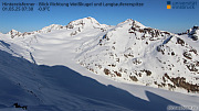
Live-Webcam-Foto of Hintereisferners:
...
DATA
The Sentinel 2 mission is part of the European Union´s Earth observation program Copernicus and
provides open-source data that can be retrieved on different platforms (e.g.
https://earthexplorer.usgs.gov, https://www.sentinel.zamg.ac.at/,
https://www.sentinel-hub.com/). Due to the twin polar-orbiting satellite system, data with high
temporal resolution can be collected. In this thesis, TCI and NDSI raster, calculated from Band
3 and 11 (Table 1), are applied. The specific Sentinel 2 data used in this case study are
so-called Level-2A (L2A) products, which provide bottom of atmosphere reflectance. Sentinel 2
L2A data is atmospherically corrected using the Sen2Cor processor and a PlanetDEM Digital
Elevation Model. It is necessary to use L2A products and not L1C products, which contain top of
the atmosphere reflectance values (ESA 2015). Multi-spectral imaging sensors enable data
acquisition with high spatial, radiometric and temporal resolution and supplies state of the art
open-source satellite data.
...
KEYWORDS
snow cover extent, LiDAR, surface classification, Sentinel 2, Intensity, NDSI, Glaciology
ACRONYMS
SLA (snow line altitude), TLS (terrestrial laser scanning), LiDAR (Light detection and ranging),
DEM (Digital elevation model), HEF (Hintereisferner), NIR (Near Infrared), VIS (Visible
Spectrum), SWIR (Shortwave Infrared), PAN (Panchromatic), ALS (Airborne Laser Scanning), NDSI
(Normalized-Difference Snow Index), TCI (True Color Image), SCE (Snow Cover Extent), AOI (Area
of Interest)
...
LINKS
MORE TO COME
more to come ...